Published in the March 21, 2016 edition.
WAKEFIELD — The first full day of spring was expected to see about 6 inches of snow fall on Wakefield overnight and this morning as a quick moving storm reminded all of us that winter isn’t bound by any calendar or celestial delineation.
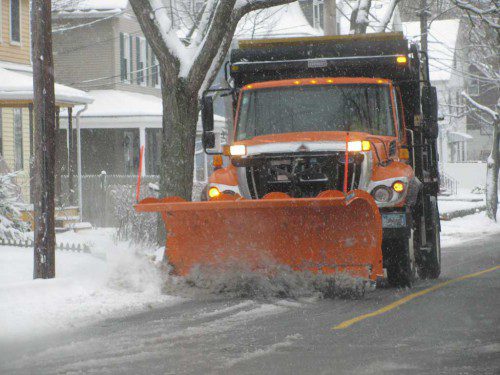
According to DPW Director Richard Stinson, crews pre-treated town streets beginning around 9 p.m. last night. A wet, heavy snow began to fall around 1 a.m. A full plowing operation — which includes about 30 pieces of Wakefield-owned equipment and about 40 privately-contracted pieces — started around 5 this morning.
Schools here had a delayed 2 hour opening, which the DPW took advantage of to clear parking lots and walkways at all the schools.
At about 8 a.m. today, Stinson reported that about 4 inches of snow had fallen with another 1 1/2 inches expected from then until the end of the storm around midday. Despite the weight of today’s snow, Stinson reported no mechanical breakdowns at the storm’s halfway point.
So far this winter storm season, Wakefield has received 31 inches of snow. The DPW has plowed and treated streets a total of six times and have only treated streets on another six separate occasions.
A winter weather advisory remained in effect until 11 this morning.
The DPW is still working with its original $750,000 appropriation for the winter of 2015-16.
In a 9:20 a.m. update, the Associated Press reported many New Englanders are breathing a sigh of relief that a snowstorm on the first full day of spring wasn’t as bad as expected.
Plymouth nurse Kathy McKee said Monday that she thought she had seen the last of snow this year and was disappointed when she saw the forecast.
But she was pleasantly surprised when the storm didn’t dump as much snow as predicted.
When she left her home, only 3 or 4 inches of snow had fallen, compared to some forecasts that had predicted as much as 10 inches of snow.
McKee says: “I’m relieved now and back looking forward to spring again.”
In its 7:20 a.m. update, the AP reported a steady snowfall was making for a slow and sloppy morning commute across southern New England.
The National Weather Service said as of 7 a.m. Monday the forecast is for the spring storm to drop 4 to 6 inches of snow across much of eastern Massachusetts, Rhode Island, northeast Connecticut and coastal areas of New Hampshire and Maine. Less snow is expected in New York, New Jersey and Pennsylvania.
Police were reporting several morning accidents, likely caused by slick roads.
Schools across the region either closed for the day or delayed opening by two hours.
Power outages across the region were minimal but dozens of flights in and out of Logan International Airport in Boston had been canceled.
No impacts were reported along the MBTA’s system. Some morning flights out of Logan International Airport were cancelled, according to the state’s Emergency Management Agency.
Many communities in the eastern half of the state were reporting between 4 and 5 inches of snow by about 9 a.m. today.


